Cities: Skylines

Cities: Skylines

283 ratings
Saarlouis
4
3
2
2
3
2
   
Award
Favorite
Favorited
Unfavorite
Map
File Size
Posted
Updated
10.216 MB
Dec 6, 2020 @ 1:28pm
Dec 14, 2020 @ 1:24pm
3 Change Notes ( view )
You need DLC to use this item.

Subscribe to download
Saarlouis

Description
- Luh mo lo, dat is doch Saarlouis!
- Eijo!
- Oh leck!

A conversation in local dialect after seeing this map

News:
The map has been voted as "Map of the month - December 2020" by BonBonB's What Map community. Thank you for your support.

Updates:
1) Thanks to adamtaylor12345 in the comments for the hint that 4 lane road with bus lanes required After Dark. I replaced it with a regular 4 lane road and removed the After Dark requirement.
2) BonBonB reviewed this map in his show. It received whooping 13/15 stars and obtained a BonBonB seal of approval. The video can be found above. All issues mentioned in the video and in the comments below have been tackled with the latest update of the map. And @BonBonB: Thank you for your time creating this review, it has been a pleaure.

Overview

This map tries to be a 1:1 representation of the area around Saarlouis[en.wikipedia.org] in the marvellous Saarland[en.wikipedia.org] in Germany at the border with France. The represented area spans roughly from Völklingen in the southeast, to Rehlingen or Beckingen in the north-west. The real life location is very diverse and offers a high contrast ranging from the rolling hills of the rural Saargau, to ironworks in Völklingen (UNESCO world heritage[www.voelklinger-huette.org]) and Dillingen and a Ford car factory and suppliers around Saarlouis. The former coal mining history of the region can even be seen on its height map: The highest point of the map is the plateau of the spoil tip in Ensdorf and the three very pointed tips of the spoil heaps “Hermann and Dorothea” in Hostenbach are very distinct and easy spot.
The map has plenty of building space for you (>90%).

Mods:
The map uses only low-poly trees… but it uses 907.607 of them and thus requires the unlimited tree mod.

As always, you can use any LUT you like. However, the LUT that can be seen during the video is the Overcast-Natural by Catch22. If using this LUT and the Daylight Classic Mod, then I recommend to switch all to AfterDark.

Road:
The Autobahn A6 and A8 provide outside connections to Germany as well as the Bundesstraße B269 / Route Nationale N 33 provides an outside connection to France. Other Bundesstraßen (~ National roads) are represented as well but they do not have an outside connection.

Rail:
The main rail along the Saar as well as the Primstal rail and the Niedtal rail are connecting to the outside. The Rosseltal and Bisttal rail lines are out-of-service and partially dismantled.

Ships:
Despite the inland port at Dillingen, I discarded shipping lines, as this would require multiple mods to ensure a good gaming experience (advanced vehicle options + river ships + ship path anarchy) and I wanted to have the requirements as small as possible. However if additional mods are no problem for you, then you can add shipping lines easily using Unlimited Outside Connections (Beta) and More Network Stuff by BloodyPenguin.

Planes:
Two flight paths are available.

Overlay Images
I have created this map using the OverLayer v2 mod. Due to popular request, I have uploaded the two overlay images.

To use it: subscribe to the mod, enable it in the content manager, paste the file named overlay.png into a specific folder on your PC. More description and the actual path name can be found on the workshop page of the OverLayer v2 mod.

You will find two images in the following google drive folder:
1) overlay.png - the basic satellite picture of the area
2) overlay_fort.png - the same picture, but with a plan of the old fortress on top of it. You have to rename it to overlay.png if you want to use it.
https://drive.google.com/drive/folders/1BPgZIXP4lW0L5EMsA2kU6OpuC_yQOATQ?usp=sharing

Be aware: These images are >50MB (5088 x 5088 px). If you activate the overlay mod for the first time after the map has loaded, the screen might freeze for a couple of seconds when the game loads this file. Once the file is in your RAM, it can be deactivate and activated quickly.

History and background information:
Saarlouis was originally founded as Sarre-Louis in 1680 after France occupied the duchy of Lorraine in the 1670 to 1672 and was going to stay after the treaty of Nijmegen in 1679. It was planned as fortress by Sébastien Le Prestre de Vaubaun[en.wikipedia.org] and Thomas de Choisy and was located at the banks of the river Saar to defend the eastern border of France. The hexagonal shape of the city results from the modern fortification techniques of that epoch and a lock even provided the possibility to flood the surrounding areas to slow down enemy attacks. The city becomes the capital of the Sarre Province in 1685 and remains a French exclave on Lorraine soil after the peace of Rijswijk in 1697. During the French revolution, it is named Sarre-Libre until 1810. In 1815, after the peace of Paris, the city is handed over to the Prussian Empire. In 1889, the now obsolete fortifications are slighted, but the original layout of the city can still be seen nowadays. The city of Neuf-Brisach[en.wikipedia.org] with a similar layout and size is still preserved until today and gives a good example how Saarlouis looked like.

The Citadel of Lille pack of Raymond Pelletier can be used to re-create the fortress. As Vauban used the local materials to construct its fortresses, the citadel of Lille uses brick-stone while Saarlouis was built with sandstone. However, I have not included the fortifications in the release of this map to give the player more freedom. Instead, I placed a row of trees to mark the original borders of the fortress.

If you want to get a feeling of the real location, check out the following videos:

A video overlooking the Saar valley from the Teufelsburg (castle):
https://www.youtube.com/watch?v=gbcOJINi8pA

Drone footage from the Saarland including much of this area:
https://www.youtube.com/watch?v=g8dxE8dKUGs

A video of Tim the Traveller about the history of the Saarland:
https://www.youtube.com/watch?v=RZ3vhPYex90


Feedback is always welcome


If you like this map, please consider to:

77 Comments
Ingenium  [author] Jun 17, 2022 @ 1:17pm 
Danke! Viel Spaß damit und schöne Grüße nach SLS.

Achja, die Altstadt und eine Pizza bei Babou bevor es in den Irish Pub geht... viel zu lange nicht mehr da gewesen :-)
Silencer Jun 12, 2022 @ 6:11am 
Als Saarlouiser sage ich direkt: WOW! Das ist mit Abstand eine der besten Entwicklungen für eine Map die ich gesehen habe. Daumen hoch!

Mal schauen wie ich nun das Stadtzentrum angehe, doch ohne die Altstadt geht es nicht ;-)
LeonRot Nov 6, 2021 @ 8:45am 
Echt eine wunderschöne Map, wenn ich die Skills und das Mass Transit DLC hätte würde ich versuchen Saarlouis sogar nach zu bauen haha
Ingenium  [author] Sep 25, 2021 @ 2:31am 
The flow is pretty weak but consistent if you do not pump from it. I recommend to pump from the "old" river arm (not connected and forms a lake on the map) and to empty the sewage to the river.
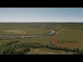
If you play with custom assets I can highly recommend the water pumps and sewage treatment facilities of Avanya which add more realism to the game.
For Mother Penguinia Sep 24, 2021 @ 5:36pm 
The river doesn't flow consistently in one direction. This is both unrealistic and causes major problems if you try to pump water from the river and empty sewage into it. I kept getting sewage in my cims' drinking water no matter where I put the pumps/drains. I really like the map other than that.
Ingenium  [author] Sep 4, 2021 @ 1:00am 
Hehe, danke. Ich war auf Heimaturlaub und bin erst am Mittwoch mit dem Rad über Wehrden nach Wadgassen an der Saar lang und dann das Bisttal hoch. Musste auch dran denken wie es ist und wie es auf der Karte aussieht. :-)
Hayu Sep 3, 2021 @ 3:56am 
irgendwie merkwürdig wenn man genau weiß wo man wohnt, und wo der ikea stehen sollte etc., aber gj!
Ingenium  [author] Jun 9, 2021 @ 1:07pm 
Hi. Thank you for the feedback. I have used the listed trees and the vanilla shrubs (=props) along the river. They are partially in the water so maybe you need prop&tree anarchy and tweak the settings in such a eay that they are shown. (Even if I do not remember that I did that, but maybe my default settings have been that way)

As a reference how it should look like, you can watch the third screenshot right of the animated gifs.
Kolantal Jun 9, 2021 @ 9:22am 
First of all, that's really a GREAT map. Thanks for sharing! I just wanted to start building on it, when I realized that there are already some 25k User props on the map. I'm subscribed to all assets you've listed here, but there seem to be lots of invisible props lining all of the rivers... Am I missing an asset here?
Ingenium  [author] Jun 4, 2021 @ 1:45pm 
Hi Luceas. Thank you for your interest in this map. However much of the current infrastructure on the map would not be feasible without mass transit. Thus the needed modifications would require a vast amount of time and I'm currently not able to invest that. I'm sorry and hope for your understanding.