Transport Fever

Transport Fever

27 평점
Belarus and neariest countries (Satellite overlay)
   
어워드
즐겨찾기
즐겨찾기됨
즐겨찾기 해제
Scenario: Europe
Misc: Map, Shader, Misc
파일 크기
게시일
업데이트일
436.561 MB
2018년 11월 10일 오후 12시 02분
2018년 11월 10일 오후 12시 23분
변경 사항 3개 ( 보기 )

다운로드 위해 구독하기
Belarus and neariest countries (Satellite overlay)

설명
Map of Republic of Belarus and neariest countries. Containing Minsk, Gomel, Vitebsk, Mogilyov, Grodno, Brest, Vilnius, Kiev, Lviv, Warsaw and Smolensk. Realistic location of factories, cities, satellite textures and terrain.

Donations welcome! I'll make more mods either way.

Donationalert: https://www.donationalerts.com/r/redkeeper
Yandex.Money https://money.yandex.ru/to/410011700660584

Have fun!
댓글 5
Divertitoff 2018년 12월 20일 오후 9시 44분 
Ну наконец-то хоть какая-то часть Украины. Спасибо большое за карту, очень реалистичная.
RolleyPovey 2018년 11월 17일 오전 8시 26분 
This is amazing! Though I do have some questions.
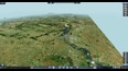
1. How do yo get your heightmaps so accurate?
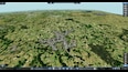
2. How do you get the satellite overlay onto the terrain?
토마토 재배기 2018년 11월 14일 오전 4시 29분 
God i love your maps :Loving: Would be awesome if you did Sweden :P I just got the Nordic vehicles from Train Fever working and really wanna use them on a proper map :sheephappy:
Vladossk  [작성자] 2018년 11월 12일 오후 11시 18분 
Great__Stuart
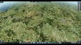
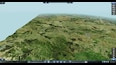
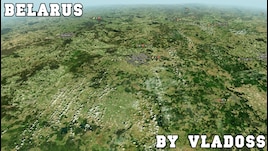
This map (and my other maps) has a true satellite image textures.
Akiyoru 2018년 11월 12일 오후 2시 03분 
What is the graphic mod that you used in your screen shot?