Arma 3
60 ratings
Range Cards for Dummies
By Greybeard
How to master the basics of Range Card production...
2
2
2
2
2
   
Award
Favorite
Favorited
Unfavorite
Intro
"A range card is a sketch of the assigned sector that a direct fire weapon system is intended to cover. A range card aids in planning and controlling fires and aids the crews and squad gunners in acquiring targets during limited visibility. It is also an aid for replacement personnel or platoons or squads to move into the position and orient on their sector. The individual soldier or gunner should make the range card so that he becomes more familiar with the terrain in his sector. He should continually assess the sector and, if necessary, update his range card. The range card is always being updated."

-or-

"A range card is a sketch or diagram of the terrain that a weapon is assigned to cover by fire. It shows possible target areas and terrain features plotted in relation to a firing position. The information on a range card is used for planning and controlling fire, for rapidly detecting and engaging targets, and for orienting replacement personnel or units. Therefore DA Form 5517-R, should be used to record the information."

Purpose


There are several goals that a Range Card seeks to achieve:
  • identifies key terrain, sectors of fire, MELs, Enemy AA, natural/man made obstacles, 'Dead Space'
  • allows several adjoining Range Cards to create a Sector (Platoon Range Card)
  • permits ANY replacing unit/Soldier to quickly conduct (RIP - Relief In Place)
  • uses a standard form for ease of use
  • allows for precise targeting points (distance, direction, T&E measurements etc.)
  • aids in targeting known points during limited visibility
Marginal Information
Includes:
  • Unit information (Fire TM/SQD; PLT etc.)
  • Magnetic North (to help orient the Soldier)
Sector Sketch Section (terrain/objects)
This field is reserved for the Soldier's topographical rendition of the terrain, its features and other targets/reference points

***Think of how the Enemy will use the terrain to their advantage***


Terrain
  • key terrain (hills; wood line; large tree; ENY AAs etc.)

  • 'Dead space' (masking terrain like depressions or ground behind hills/objects)

  • natural obstacles (rocks, rivers, thick vegetation etc.)

Man Made Objects
  • defensive/offensive emplacements (wire obstacles; mines, Dragoon's Teeth etc.)
  • structures (houses, farms, antennas etc.)
Sector Sketch Section (military symbols)
Range Card Symbol

Shoot an azimuth/distance from a known point to your position an label it with a line and "V" tic marks
    Each Range Card should show what type of weapon system is houses (at the center of the dot)
    • MG, AT, AR etc.
    • other military related symbol as appropriate


Data Section 1


Here's where it gets a little tricky...

Sector of fires
  • Primary (solid 'V' lines)
  • Secondary/Alternate (dash marker 'V' lines)


"Dead' space is marked only for FPLs by not blackening the line to the approximate length of space
Your PDF (Primary Direction of Fire) is always laid on your most important target coverage (#1)
Your FPL (Final Protective Line is your right OR left limit AND your grazing fire
Grazing fire is 1 meter off the ground to prevent Enemy Soldiers from flanking you while they low crawl

***Range Cards use either a PDF OR a FPL but never both***


Use the remarks section to describe where the position lies

You must ALWAYS have No.1 and 2 as a right and left limit (even if only marked by a FPL)
Your Range Card MUST use a PDF or FPL
All other Numbers must be targets and/or TRPs (Target Reference Points)

Machine gun use

Use your tripod for maximum efficiency
Keep your right and left limit to less than or equal to 875 mils (traverse limits of the tripod)
Allows you to be extremely precise with your windage and elevation measurements
Data Section 2
A Range Card must accurately describe the surrounding terrain to aid in target acquisition

Each of the 9 circles represent a set distance that the user can choose. To decide on what distance each circle should be, perform the following:
  • identify the MEL (Maximum Engagement Line) of your FURTHEST weapon
-or-
  • identify the FURTHEST possible engagement distance based on terrain
For example:
If your MG team can effectively reach out to targets at 900 meters, then each 'ring' would measure 100 meters
-or-
If your MG could reach out to 900 meters but is masked by a ridge line at 450 meters, then each ring would be 50 meters

Once you've identified your MELs and set your distance scale then you must represent the terrain
  • draw any and all terrain features (elevation/depression etc.)
  • represent any 'Dead space'
  • illustrate natural/man made obstacles
Target description

Use "L" or "R" to describe which side your target lays on
Describe the distance in meters
Have a target 'flow' from one side of your sector to the other side to increase target recognition
Express the target elevation in meters (important also for indirect fire)
Range your target in meters
If you need to use special ammunition types, mark down which ones (HE/AP/HEDP etc.)
Describe your target (PDF/FPL; large tree; intersection; shack; vehicle etc.)
Use the 'Remarks' section for any useful instruction/comments etc.
SQD/PLT Sector Sketch

SQD


PLT

When several Range Cards are tied in together, they form a Sector Sketch

A Sector Sketch is usually a SQD/PLT sized area. Sometimes a COY sketch may be made

Steps for Sector Sketches

Conclusion
***Range Cards are constantly updated and reviewed to ensure reliability***

Range Cards allow a Soldier to accurately describe the surrounding tactical environment. This significantly increases their lethality on the Battlefield, especially during hours of limited visibility. Any Soldier who will subsequently occupy that battle position will be able to immediately orient themselves to their target/surroundings.
17 Comments
Greybeard  [author] Jan 10 @ 6:50am 
Knowledge is power and I appreciate the feedback!
Neshimi Jan 6 @ 11:46am 
This is a fascinating deep dive on the use of range cards, and I'm glad it's here. though there's virtually no way it'd be useful to my Arma group, for two major reasons.
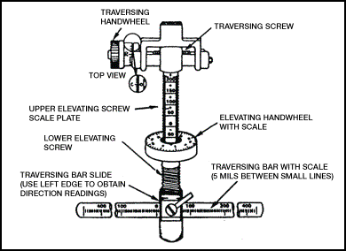
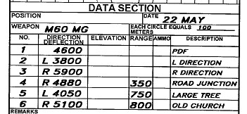
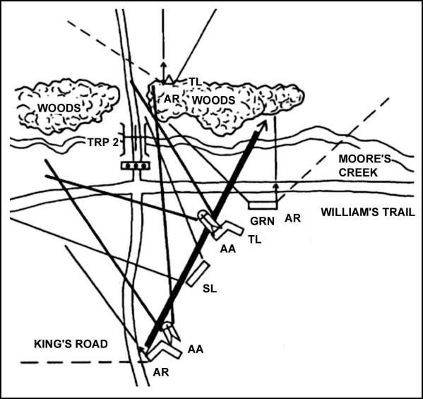
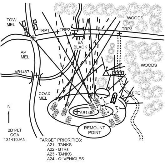
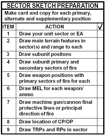
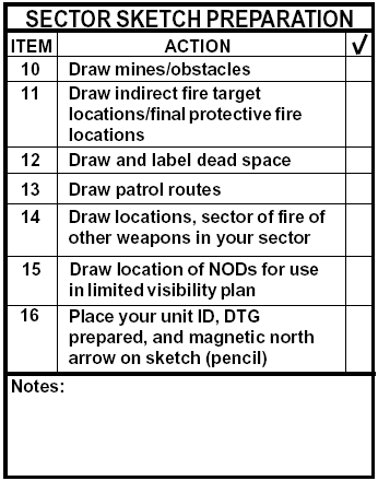
1. Range cards don't do this in Arma, and even if they did, the map markings pretty effectively cover that base, and they're shared to boot.
2. If we were to replace the existing systems we use with a working set of range cards, it would be frustrating to get our whole group on the same page, it'd take many more total man-hours to update our cards, and our positions tend to change too frequently for that to be tenable.
3. Our group is chock full of high functioning r e - t a r d s that can barely count, let alone remember to update a drawing every few minutes during a firefight.

Thanks for the great tutorial though. :cozyspaceengineersc:
Greybeard  [author] Oct 26, 2023 @ 6:15pm 
Folks...Steam deserves only the best! And a range card mod has got to be out there somewhere!?!
Nathan Oct 26, 2023 @ 10:17am 
great range card explanation but why it on steam tho???
Greybeard  [author] May 25, 2023 @ 7:14pm 
Inquiring minds want to know!
Sandman13 May 25, 2023 @ 2:40pm 
Why is this on steam?
ElPincheBean Mar 7, 2023 @ 9:49am 
Im using this thread to teach a class for LTT! Truly helpful!
tonyBAN Feb 21, 2023 @ 5:35pm 
What!! This is was in Steam?
Bum Aug 16, 2022 @ 4:54pm 
for real lol, I'm using this for Cpl's course now
Greybeard  [author] Apr 26, 2022 @ 3:30pm 
Lt...What a time to be alive !