American Truck Simulator

American Truck Simulator

372 평점
Understanding Road Signs and Road Markings
TomBoi 님이 작성
For those of you who don't live in the United States, I will list all of the road markings, road signs, and other road related stuffs. I highly encourage you read this guide if you don't live in North America, so you can enjoy ATS in the way it was ment to be played.

I will be taking credit from Wikipedia, as I've heard that it's really good when it comes to this stuff, as well as my personal experience of driving the roads in America.

If anyone is bilingual and wants to translate this guide into another language, please contact me on my Steam Profile. I will be happy for anyone that would like to do that.
2
4
   
어워드
즐겨찾기
즐겨찾기됨
즐겨찾기 해제
Welcome!
Hello, and welcome to my guide! If you clicked on this, you are probably here just to learn about how the road signs and markings work here in the United States of America.

This guide will tell you what lines tell you what you can and can't do, what the colors mean on signs, and the road systems. I will also be listing information on any sign that may or has made an apperance in American Truck Simulator. If you have a recommendation for a sign to put in, please tell me in the comments below.

Hopefully after reading this you will learn a little bit about America's roads, and how to drive them properly.

A fun fact to start off, the USA has the largest network of roadways, with just over 4 million miles of roadways. That is plenty for SCS to work with.


Lets begin with Road Markings.
Road Markings
Double Solid Yellow Lines: Most commonly found on 2 lane side-by-side rural highways, these lines indicate that no passing can happen. Found on parts of the highway where there are lots of blind spots, like curvy roads and roads going over hills. They also show up on city roads as well.


Half Solid-Half Broken Yellow Lines: Very simliar to the Double Solid Yellow Lines, this road marking indicates that the side the broken line is on, that side of the road can pass, whilst the other side cannot. Only found on 2 lane side-by-side rural roads, and they can appear anywhere on those roads.


Single Broken Yellow Line: Like the last 2, only this marking indicates that either side can pass. Found on wide open, visible stretches of road.


Center Turning Lane: There isn't really a marking for this road feature, but this is a whole lane for people who want to ONLY turn left in. Arrows curving left on the lane itself indicates this lane, as well as a pair of solid yellow lines and broken yellow lines on each side of the lane.


Single Broken White Line: This marking indicates lanes on roads that have 2 or more lanes on one side of the road. People are free to change lanes except in intersections.


Short Broken White Line: Very similar to what's up above, but these lines indicate merging lanes for getting off a certain strech of road. You will commonly find these on exits on Interstates and other roads of the like.


Single Solid White Line: This means that lane changing is discouraged, but not illegal. This is found mainly on parts of multi-lane highways where construction is occuring.


Double Solid White Lines: These lines mean that lane changing is illegal. Shown in the picture below, they can happen anywhere where traffic needs to be controlled, like in metropolitan areas where toll lanes exist.


Stop Line: If a pair of crosswalk lines or zebra stripes don't exist, there is usually a line indicating where to stop at an intersection, and may come with the word STOP in all caps. At intersections with lights, you stop at the line when it's red, and then you can turn right if applicable. At intersections with stop signs, you stop at the line, and wait for an opening to go out.

Sometimes, neither of the markings show up on the road, to where you stop at the stop sign, and pull forward if you are turning and you need to see. Lights will always have either a stop line, or a pedestrian crosswalk to stop at.


Crosswalk Lines or Zebra Stripes: These take the place of the Stop Line when there is a crosswalk for people to go across. You stop at the closest line to you at a red light or at the bottom of the zebra stripes.
Road Signs (Colors)
All of the road signs in the US are color-coded so people can see what type of sign it is from a distance. Each of the colors have different meanings and alot of the signs I will list below also come in different colors as well.


White: The color white is used as the background for all of the regulatory signs, such as speed limits, stop signs, and other signs of the like. Regulatory basically means by law, so these signs you need to follow.


Red: Red is used as a supplement color for stop signs, yield signs, 4 way, Do Not Enter, and a couple of others. They mostly relate to the direction of movement, either stopping, or just that you are going the wrong way down a road.


Orange: Orange is reserved as the background for temporary road work signs. A lot of the warning signs you will see later can also show up in orange as well.


Yellow: This common color is mostly used on the background of warning signs. You don't need to follow them by law, they just warn you of upcomming events on the road.


Green: Green is used on the background of signs that tell of the driver of distance to and from attractions, cities, and roads.


Blue: Mainly used for traveling services, like rest stops, information on traveling, and other places.


Brown: Brown is mostly used for signs referring to historical sites and other points of interest. A great example of this is the Historical US 66 sign that shows up whenever you are near the famous highway.


Black: The color black only shows up as the background on one way signs, night speed limits, and obviously the color of the text on some signs.
Road Signs (Follow By Law)
These right here are the road signs that you have to follow. Typically, signs you have to follow have white backgrounds, but some signs are different, for example, the night time speed limit sign.
Sign
Description
Obvious is obvious. You stop here.
This acts like a Stop sign in some ways. If there is traffic in the way, give way to them.
Accompanied by either below a Stop sign or Yield sign, dictates the roads going into and out of an intersection. The number can be replaced by a different, more applicable number. Ex. 3-way for T-intersections.
Shows the speed limit of the current road at that point for all vehicles, unless stated otherwise. Limit increases and decreases by increments of 5.
Shows the speed limit for trucks. Displayed below the Speed Limit sign. When displayed, ALL commercial trucks have to follow the limit.
A different variation of the Trucks speed limit sign, but it says "Trucks 3 Axles or more (insert speed here) Maximum". It's kind of dumb, and long, and just having the word "Trucks" would also include 2 axle moving trucks aswell. SCS, just change it to keep it simple.
Shows the speed limit for nighttime driving.
You must stay above this speed to stay on the road. Mainly found on Interstate controlled access highways. This prevents accidents with slow vehicles.
Shows the lanes that restrict directions at intersections. The basic formula can be changed to apply to the road. Usually accompanied by road markings.
No Right Turn allowed. Left arrow can also be shown as well. The words "On Red" can also show up, meaning that you can't turn right on red at traffic light intersections.
No U-Turn can be allowed on the left turn lane in intersections.
Sign says all. From this point on, do not pass. Accompanied by the Double Solid Yellow Lines.
Passing zone begins. You can pass from this point on until the "Do Not Pass" sign shows up again. Accompanied by Half-and-Half Yellow Lines or Single Broken Yellow Line.
Slow traffic, including trucks, must keep to the right to keep the fast lane open. Other variation includes "Trucks Use Right Lane".
When a median shows up, you keep to the right. Another variation is the arrow on the left side of the median. This variation isn't really common; I only know of one place so far that I have seen it. A different variation is the words "Keep Left/Right" with a corresponding arrow.
Obvious is obvious. Accompanied by Double Solid White Lines.
Obvious is obvious. Shows up on the exits of freeways to keep people from going into the exits the wrong way.
Indicates the wrong way on a stretch of roads. Most of the time this sign is below the "Do Not Enter" sign.
The direction of the arrow indicates the flow of traffic on a stretch of road. Also shows up as a vertical rectangle sign with "One Way" and the arrow below the letters.
Indicates a center turn lane where you can ONLY turn left in. You can't use this lane to pass at all.
This tells of the driver where the passing zone ends. This is the only sign that shows up on the left side of the road. The No Passing Zone sign corresponds to the road lines shown as is.
Road Signs (Warning)
These signs here are not to be required by law to follow, but are often warnings of something upcomming, or information of other things, like cities and attractions. Most of the warning signs will have a yellow background, meaning to take those signs into consideration.
Sign
Description
This shows up at an intersection when you are crossing a divided highway, either state highway or U.S. highway. This will not show up on Interstates because of the nature of Interstates are to be control-accessed. (exits and entrance ramps)
Indicates the approach of a weigh station. At the exit for a weigh station, the distance is replaced with an arrow pointing in the direction of the exit.
Indicates when you are crossing at a railroad intersection. The crossbuck is also painted on the road to accompany.
Warns you about an upcomming crossbuck.
Warns you about an upcoming left turn. Arrow can point to the right to warn you about an upcoming right turn.
Warns you of an upcomming left curve. As with the Turn sign, a right arrow indicates a right curve. A number can also show up on the inside of the curve to show you the recommended speed to take around the curve.
Warns the driver about the overabundance of turns on a curvy road. Also can show up as a left side version.
Warns the driver of a upcoming right hairpin curve. Also shows up as a left variation.
Warns truck drivers going into a curve about the possibility of tipping over if they are going too fast.
A chevoron arrow to point either left or right to indicate direction. This sign is usually in a group of 5 or 6 of the same sign that shows up after a turn or curve sign. Shows up on the outside of a curve.
Warns the driver about a 4 way cross intersection.
Warns the driver of a side road interesection that is perpendicular to the road you are on. Also shows up as a left variation.
Warns the driver of a T-intersection.
Warns the driver about a roundabout that is coming up.
Warns the driver of an upcomming stop sign.
Warns the driver of an upcomming yield sign.
Warns the driver of a speed change.
Warns the driver of an upcomming traffic light.
Warns the driver of a merging lane. Shows up on divided highways and interstates where roads merge onto the main road.
Warns the driver of the right lane merging into the left lane.
A lane that is merging is added to the lane count of the roadway.
Warns the driver of either a divided highway beginning, or an upcomming median.
Warns drivers of a steep grade that the driver is either going down or up. A percentage of the grade might show up under this sign, or just the percent of the grade will show up.
Warns the driver about the right lane ending. May or may not merge into left lane.
Yes, this is a real sign, and warns of the tanks that may cross the road. (SCS, please add this in as an easter egg.)
Warns drivers on the main road of a hidden driveway that has a blind side.
Drivers should take this speed into consideration. Mainly shows up on exit ramps to show recommended speeds that vehicles should take. Depending on the situation, vehicles may go faster or slower than the recommended posted speed.
Warns the driver about a road that doesn't continue on. May also say "No Outlet."
Warns drivers about the current freeway they are on is ending.
Road Signs (Informational Highway)
These road signs here show the roads that are upcomming, as well as other information. Any sign relating to distance or exits will have a green background. Signs that talk about restaurants and hotels will have a blue background.


This is the sign that shows up on divided highways and interstates. If there is an exit number, it will show up on top. The highway or interstate that you are getting on will show up on the top center, and the bottom center shows any towns or roads that you may encounter when you take this exit. Lastly, on the very bottom, it shows you the distance until the exit shows up.


On interchanges, some exits will be a left exit instead of the traditional right exit. In these instances, trucks are not banned from being in the left lane. The signs for left exits will be on the left side of the road as an easy way to notice them, or the yellow "LEFT" sign will be on the left side of a sign.


This is another form of an exit sign. Arrows point to lanes dictating which lanes go to what. For example, the 2 left lanes and the middle lane stay on I-435 East. Another sign, pointing to the lane between the middle and right lanes is the exit lane for I-35 to Wichita, KS, or Des Moines, IA. If you want to take that road, stay in that lane. Finally, on the right, is the exit for Lackman Road, on exit 1A. You can tell its an exit lane from the yellow box that says, "EXIT ONLY". This makes it easy to spot from a distance, so you can switch lanes according. The next exit would be for I-35, as the exit lane for Lackman Road would peel off. The signs change from situation from situation, but the idea and principle are similar. Lanes leading to destinations are pointed to with the direction shown above; exit lanes are yellow boxes.


Tells the driver of an exit, and the number of the exit if there is one. The number of the exit is dependent on the mile marker rounded to the nearest whole number. Also, if multiple exits exist within a mile, they are subdivided by letters (ex. 235A, 235B). Speaking of...


Mile markers tell you how far along a route you are. These are most common on divided highways and interstate highways. The way these signs get their numbers are based on how far from a state's boarder it is. Mile numbers get larger from west to east, and south to north. So, for example, you can find mile marker 1 on either the west side of the state, or the south side of the state. Mile markers exist every .2 (two-tenths) of a mile.


This sign lists off towns on your route and how far away they are in miles.


This tells drivers of any commodities are avaliable, like food, lodging, attractions, or other things. Also listed is the exit number that these commodities are available.


This tells drivers of an upcomming rest area, and the distance left to get there or and arrow indicating a rest area.


Certain stretches of highway will be designated as a toll road. Markings will be present for the last exit before reaching the start of the toll road. Toll roads commonly exist in Oklahoma, Kansas, and Pennsylvania, so keep an eye out for these special stretches of road. Similar markings will exist for toll bridges wherever they exist.


When approaching toll booths, you have the option of either stopping at a physical booth, or automatically getting charged via an automated toll pass system. Every truck you drive will be equipped with a pass like this that automatically bills you so you don't need to stop.
Other Highway Road Signs & Features
These signs here listed are situational signs, only showing up in certain places. I decided to make this section because of the character limit on guide sections.

The signs listed below have shown up in game versions 1.5 and later.

Truck Lane: Going up hills make trucks the slower vehicle, due to the amount of weight involved. So, on highways, both two lane side-by-side, and divided, they might come with a lane dedicated to slow trucks, as shown below.
(Steam doesn't allow uploads larger than 2 MB, therefore you have to deal with 240p resolution on the GIF)
Sometimes, the sign that indicates truck lanes or steep grades have flashing yellow lights to warn truck drivers about the feature. In my experiences in Colorado (which has been once), these lanes happen so often they are reduced to just a plain white sign with nothing on it.


Memorial Highways: Certain highways or bridges will have signs next to them that commemorate a group of individuals that did something. These are just there to remember those who did a great act, for example, the sign below.


This was a screenshot I took, and its kinda hard to read. Blowing up the picture will show that it says "Kern County Korean War Veterans". They are just there to remember those, nothing really vital to your road journey, but it makes you remember those who has served our country, or community, or other groups.


Runaway Ramp: Trucks use airbrakes, yes? And sometimes, going down steep grades, the truck brakes may fail. As a precaution to keep trucks from wrecking into other vehicles, certain stretches of highway will come with Runaway Ramps or Lanes. The style differs from place to place. Some have upwards hills that are so steep that trucks will stop there, and others are just sand pits, kind of how at the end of drag strips there's a sand pit to stop drag cars that can't pull their parachute.

If you don't have the box checked in the options to enable air brakes simulation, you will never need this road feature in the game. However, if you are daring and turn it on, be warned. Going down steep grades, you may need to use these.


Roundabouts: Something that exists a lot in Europe but is getting adopted by the masses in the US is the roundabout. They function much the same as they do in Europe, as you would expect. There exists a single lane roundabout and dual lane roundabouts. Single lane roundabouts are simple to understand: yield to traffic within the roundabout and exit where you need to exit. Dual lane roundabouts are a bit more complex. The left lane is usually reserved for traffic going left in the roundabout, and the right lane is reserved for traffic going right in the roundabout. Traffic going straight usually can stay in either lane in this instance. Sometimes roundabouts come with a curb for large trucks to use to easily get around.


Diverging Diamond Interchange: Intersections at interchanges really suck when traffic is high. Roundabouts are great and all, but they take up a lot of space, and not best for large vehicles. So, thats when the diverging diamond comes into play. A very new type of intersection that is still being researched, this alleviates a lot of traffic backup at interchanges. Essentially, you swap from driving on the right side of the road to the left, and back to the right when you leave the interchange. The intersection is managed by traffic lights on both ends and leaves room and gives efficiency to traffic getting on or off the controlled highway. Expect to see this a lot more as more and more interchanges switch to this more efficient style for high traffic areas.


Weigh Stations and Port of Entry's: Often times when driving, you will be kindly asked to pull over at a weigh station to ensure that you are at a legal weight. If not, you will encounter a fine. Even though your gross weight for most loads in game will not go over 80,000 pounds (36,288 kilograms), you still need to pull over at weigh stations to ensure a legal weight is met.

Accompanying a weigh station sign is also a digital sign that says Open or Closed, and luckily, not every time you see a weigh station do you need to pull over at it. There is a small device on the windshield of trucks that beeps and shows a light for whether or not you need to pull over. Left exits also exist for weigh stations, so keep that in mind for being in the right lane at the right time.

Port of Entry is sometimes also used for weigh stations that are at state boarders, but they work the same as regular weigh stations, just using different verbiage.


Agricultural Inspection: When entering California, every incoming vehicle must stop at an agricultural stop, and their main purpose is to stop and/or slow the move of invasive species that may damage the ecosystem. They show up on all the interstates and highways for traffic that is incoming to California after the state boarder. There isn't anything to worry about in ATS, nothing that you will transport will contain an animal or plant that will send California into further hell. The only other states to have some sort of Ag Inspection would be Florida and Hawaii, so expect SCS to implement them when Florida is being worked on.
Road Signs (Construction)
These signs indicate construction if there is any at all on the roads. These signs will all have orange backgrounds. The previously mentioned Warning signs can also be orange as well if they are used in a construction area, so there is that to note.
Sign
Description
Indicates how long the construction area is.
Indicates the end of a road work area.
There is a worker up ahead that may direct traffic. Sometimes they might have a sign that says "SLOW" on one side and "STOP" on the other. They act very much like a traffic light, and currently in the game, traffic lights guide traffic in situations where one lane on a two lane side-by-side is closed. Maybe in the future, SCS will add NPCs that flag or spin the sign in these situations.
Road Signs and Highway Naming (1/2)
Here, I will show you the different ways highways and interstates are named. These symbols can show up on a sign on their own, or accompanied by other signs.


Interstate Highways: These streaches of road are the main roads to get on for long distance travel. Maximising efficiency with multiple lanes and high-speeds, these roads should be traveled on to get somewhere quickly. A big difference that differentiates Interstates between US Highways and State Highways is that Interstates are controlled-access. This means that the only way to get on and off Interstates are by either A) The Interstate ends and turns into a Highway or regular road, or B) the use of interchanges. This change makes it where traveling Interstates in urbanized areas doesn't mean you will be stopping for traffic lights, making traveling even more streamlined. The logo is uniform across the whole U.S. so finding them isn't that hard.

The names are here for a reason other than differentiating highways. Even numbered Interstates are East-West orientated, whilst odd numbered Interstates are North-South orientated. Lower numbered interstates start in the west or south (i.e I-5 on the West Coast and I-10 in the South), and the numbers get larger the farther east or north you go (I-95 on the East Coast and I-90 in the North). Another thing to add: if the Interstate is a multiple of 5, so either it ends in 5 or 0, that Interstate will run boarder to boarder, coast to coast.

If all of this is a little confusing, I have some examples listed below.


Interstate 90, or also named I-90, is an Interstate that stretches from Seattle, Washington to Boston, Massachusetts. That is why I-90 gets an even number.


I-29 is an interstate that runs from Kansas City, Missouri, to Pembina, North Dakota, where the Canadian boarder is. That is why I-29 gets its odd number.

There are also Auxilliary Interstate Highways. These exist in metropolitan areas and carry 3 digits. The first digit depends on whether the Aux Interstate is either a loop or a spur. Spur Interstates are Interstates leading into a metropolitan area, and are given an odd first digit, whilst Loop Interstates circle around a metropolitan area, and are given an even first digit.


I-680 is a loop that circles around the northwest half of Omaha, Nebraska. Due to it being part of a loop, it is given an even first digit.


I-110 is a spur that links I-10 and I-5 to the Port of Los Angeles in Los Angeles, California. Due to it emptying out into a city, it carries an odd first digit.


If for some reason you find an intra-planatery portal to the Hawaiian island of O'ahu and end up there, the interstates are prenoted with an H prefix. There's only 4 interstates in Hawaii: H1, H2, H3, and H201. There's a pretty low chance that Hawaii will be added in SCS, however, with modding, anything is possible.

The interstate system is similar for Alaska and Puerto Rico, US's commonwealth territory. The 'A' prefix is for Alaska and 'PR' is for Puerto Rico. Again, very unlikely these states outside the Contiguous 48 will be added officially by SCS, but modders will probably make these map expansions.


U.S. Highways: These highways are a tier down from Interstates, and can either be divided, or side-by-side. These were originally very major ways to travel, but now they are mostly overtaken by Interstates. US Highways are still useful for reaching smaller towns and other underdeveloped areas, such as the Western US, and unlike Interstates, they are quite fun to drive. Highways change between using interchanges, and intersections, either with or without stoplights. The logo is also uniform across the whole U.S., just like the Interstate sign, except this is a basic white shield.

The numbering system for U.S. Highways are identical to how the Interstate numbering system is set up, but the North-South/ East-West order is reversed to avoid confusion between the two different types of highways, if a mistake is made in the written or spoken directions, for instance. This means, for example, U.S. 95 in the west and Interstate 95 in the east are on complete opposite ends of the country.


U.S. 6 is a major highway that streaches from Bishop, California, all the way to Providencetown, Massechusetts. This highway passes through Denver, Colorado, Des Moines, Iowa, and Cleveland, Ohio, to name a few of the major cities this highway passes through.


State Highways:The last in the hiarchy of road systems in the U.S are State Highways. These only exist in the state that they belong in. Because of this, you have to be weary about how the State Highways are labeled. A key difference between State Hwys and US Hwys is the fact that US Hwys are built to a standard, while State Hwys vary in quality. Roads such as the CA 99 are built much the same as an Interstate would, while lesser known routes between towns and villages are lesser maintained and are of lower quality.

All State Highway signs are based off of this simple design.


However, designs may vary. Most are very similar to design and color, but some are vastly different, like in California, with it's spearheaded green background with white outline.


Some State Highway systems also come with their own loop, link, and spur highways as well, to note. Certain States like Texas, for example, have their own highway system known as Farm to Market or Ranch to Market highways, which their specific purpose was connecting rural areas to towns to sell their goods. These may come into ATS when SCS works on Texas, due to the large precense of farms and ranches existing in that state.


I put a link in here[www.routemarkers.com] to show you all 50 states with their respective state highway signs. It would take a while to put pictures in for all 50 states and Washington D.C. Plus, some of you don't care. If you want to see them, there's the link.


Business Route: Business Routes are split off the main highway or interstate and is a road that goes right through a business district in a city. Sometimes the business route was part of it's parent highway then had a bypass built around it. Signs for these are your typical highway and interstate signs, but instead of their base colors they are green and say BUSINESS in all caps. Other than being part of the highway system there isn't much else to these roads.


There are three lower tiers of roads that exist in the US, county highways, township roads, and fire roads. These roads are listed in various ways depending on jurisdiction.
Road Signs and Highway Naming (2/2)
This section got too thick for the Steam Guide system to handle, so this is Part 2.

County Highways: These roads in the US are the lowest tier on the highway system, and are mostly unused and made to connect other highways and towns. For the most part, due to their lack of importance, SCS may never really introduce county highways into the game. There is really only one county highway that is worth mentioning that could be included in the game, especially if Las Vegas gets the rebuild treatment.

Clark County 215 is an interim county highway that is part of the Las Vegas Beltway, and part of the highway is assigned alongside Interstate 215. The reason why this interstate grade county highway is designated as such is for a few reasons. Even though the highway is close to interstate status, it misses a few certain things to make it an interstate, and the process of interstate classification is a long term process. So in the meantime, the entire beltway was funded by county taxes, and is managed by the county itself. Therefore, it has a county highway designation, even though it could very easily be interstate or US Highway. Plans are in the future to replace the CC 215 designation with I-215 designation, but in the meantime, that is how it sits.


Turnpikes/Toll Roads: Certain stretches of road will be designated as a turnpike or toll road. They aren't too common, as part of US taxpayer federal and state funds go towards the maintenance of interstate highways and state roads. Toll roads still exist for roads that either require higher maintenance or to curb traffic loads. Many turnpikes existed before the advent of the interstate highway system, and were automatically turned into interstates at the introduction of the act in the 1950s.

Many of these turnpikes contain European style rest areas with gas stations attached so drivers don't leave the turnpike, and traffic slowdown is almost non-existent. Each turnpike has their own signage that is often the logo of the turnpike association. Shown below is the signage and logo for the Kansas Turnpike, which runs on I-35 and I-70 through Wichita, Topeka, and ends outside of Kansas City.

Township Roads: These are roads that connect local businesses and residencies to each other within a village, town, or city. All township roads are either 2 lanes, 4 lanes, or some combination of them, and all will only have intersections and roundabouts. Traffic lights commonly dot intersections, so stoppages are expected. Roads will have their road signs on the traffic lights within SCS, no standalone street signs exist as of yet within SCS. If a township road happens to also share a State or US Highway, the road marking for that will show up on the sign alongside the street name.


Fire/Logging Roads: The last road type worth mentioning in this guide are fire roads and logging roads. Both are similar in function and design. These roads have little to no maintenance by any authority, and are unmarked dirt roads. These commonly are located in forested or mountainous areas. The main purpose of a fire road is to provide fire rescue with land access to certain areas for putting out forest fires. It's unintended purpose is for off roaders to use them for leisure. Logging roads are similar, with their main use is for transport of trucks and equipment for logging businesses. SCS has some logging roads in the Sierra Nevada and Rocky Mountain regions for deliveries to be made, and these routes are the roughest to deliver on. If these roads are commonly driven on, it might be worth it to specialize your truck with rugged tires, different chassis layouts, and the like.
Conclusion
Thanks for reading this. Hopefully you got something out of this, and you know now why this guy in ATS Multiplayer is yelling at you for passing over a double solid yellow line. If there is anything to add, please put it down in the description below. Also, share this to your foreign friends that also play ATS so they can understand how this game works. This guide can also work for travel as well, not just video games, so there's a bonus.

Thank you all for making this one of the top rated guides for ATS! I'm happy that I helped out so many people with this, and also had a bit of fun with it too! I don't play ATS that much anymore because of life and interests, but periodically I will update this guide with new and updated information.

Hope you liked this, and safe driving!
~TomBoi
Update Notes
Feburary 14, 2016: Guide creation

Feburary 28, 2016: Changed a sentence in first section about road markings; added update notes section.

March 4, 2016: Added "Road Signs (Colors)" section that needed to be added.

March 28, 2016: Added something about Short White Broken Lines to "Road Markings". Thanks to Ford Explorer(VTX3) for reminding me about this.

April 17th, 2016: Added "Center Turn Lane" feature in Road Markings, and "Center Turn Lane Only" Sign in Regulatory Road Signs.

July 18th, 2016: Added a link in the Interstates and Highways section to a page with all of the State Highway signs for those who want to see.

October 10th, 2016: Added a notice for anyone who wants to translate my guide into other languages in "Conclusion".

October 21st, 2016: Added "Welcome" section to make myself look more friendly. Also mentioned Farm-to-Market/Ranch-to-Market roads in "Road Signs and Highway Naming" section.

November 25th, 2016: Added "Other Highway Road Signs" section due to character limit in sections, and added Truck Lanes and Memorial Highway subjects in that section. Also added another highway sign in "Road Signs (Informational Highway)", and the No Passing Zone sign in "Road Signs (Follow by Law)".

January 1st, 2017: Added in the Runaway Ramp feature in "Other Highway Road Signs" section, and added the Truck Speed Limit variation in the "Follow by Law" section.

March 14th, 2017: Added visitor milestone of 3,000 and One Year anniversary in Conclusion section.

October 3rd, 2017: I had to fix the Road Signs (Informational Highway) section. Formating was messed up for some reason. I added one picture, and changed one picture out. Also added additional information to the Road Signs and Highway Naming section.

November 10, 2017: Added "Business Route" to Road Signs and Highway Naming section.

January 5th, 2018: Added more clarification in Road Signs and Highway Naming section.
Also added a sign in the Road Signs (Construction)

November 24th, 2018: Added the highly requested brown color to Road Signs (Colors). How I just got around to it after they showed up in Arizona I don't know. Procrastination I guess. Thanks to @funkybacon for asking for it.

November 11th, 2019: Renamed "Other Highway Road Signs" to "Other Highway Road Signs And Features"; Added Roundabout and Diverging Diamond Interchange to "Other Highway Road Signs and Features"; Added new thanks message for Conclusion; Jokingly added a section in Road Signs and Highway Naming about interstates outside the Contiguous 48 (Alaska, Hawaii, and Puerto Rico) because I was bored.

December 19th, 2022: Updated formatting to include breaker lines to make reading more digestible, also added Part 2 to Road Signs and Highway Naming to go into further explanation on certain road types. Added Left Exit Signs to Road Signs (Informational Highway). Added Weigh Stations and Agriculture Inspection to Other Highway Road Signs and Features.

January 11th, 2024: Added information relating to turnpikes and toll roads to the guide.
댓글 95
bialinegrito_02 2023년 4월 5일 오후 3시 44분 
Dónde consigo camiones?!!
omadept686 2022년 10월 31일 오후 12시 11분 
parallel parking?
Laika 2022년 1월 6일 오전 8시 31분 
Thanks for this detailed guide! I really learned something here, for example the odd/even numbers representing East-West and North-South. :steerme:
HochgeborenKlown 2021년 7월 30일 오전 8시 54분 
Thanks you...I live on Lackman Road about 8 miles north of that exit...
[B]-Lt Karnage 2021년 6월 4일 오후 11시 33분 
@AlconburyBlues thanks for all this information. And Thanks to Tomboi for the guide.
AlconburyBlues 2021년 6월 4일 오전 12시 10분 
Sorry, just want to add my opinion about Truck Lanes and I'm done. When will SCS make it so cars don't use these lanes as in RL? They need to fix the AI paths so that AI cars change lanes to the left to avoid them.

Gets annoying when you need to use these and cars in there blocking you, or worse, they change lanes into it in front of you. And if you do have Air Brakes Simulation turned on, I would advise turning fines off. Because you are going to hit a few if your brakes fail. I'm always saying to myself "Hey! Get out of my lane! You don't belong here!"

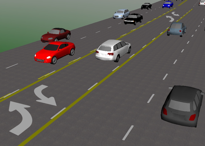
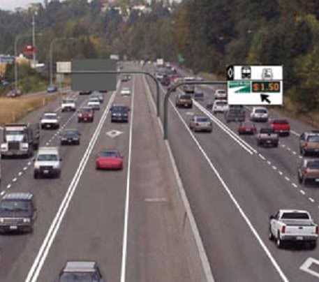
I haven't researched this one in a while. But the last time I checked it was well over a $1000-2000 fine for a car driving in the Truck Lane.
AlconburyBlues 2021년 6월 3일 오후 11시 56분 
Oh and one other thing to learn (but has nothing to do with this sim). Bicycles count as pedestrians in the US. And ALL pedestrians have the right-of-way, as long as they are law abiding themselves. This is true in the ENTIRE country except one place. The 5 counties that make up New York City.

This is why people make fun of New Yorkers when they start raging against pedestrians and bicycle riders anywhere else in the country. They honestly believe their law applies everywhere. Go figure.
AlconburyBlues 2021년 6월 3일 오후 11시 52분 
Just an FYI about Stop Lines and Pedestrian Crosswalks. Your info is incorrect about where to stop with crosswalk lanes and zebra stripes. You DO NOT stop at the crosswalk line closest to you. This is a bad habit that most American drivers have, but it's not lawful.

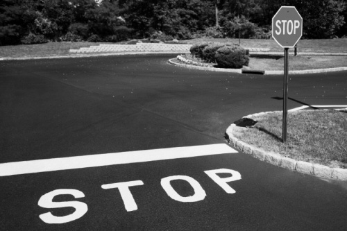
Most of the time these crosswalk lanes are accompanied by a completely independent stop line in front of it. This is where you stop your front tires at. But if there is no stop line, you must stop short of the crosswalk, not at it. (The last time I checked, the law in most states says 5 feet from any pedestrian crossing.) This is a fact in all 50 states. If your bumper has crossed over into the crosswalk path (i.e. by stopping your front tires at the line closest to you), you have broken the law.

The unfortunate side of this is that most US Police departments don't even enforce this, unless there is a complaint, or at worst, an accident with a pedestrian.
ItsjustTyler 2021년 5월 17일 오후 1시 17분 
i love it. now i know more about road signs
:steamhappy:
thelaw1021 2020년 7월 14일 오후 4시 58분 
Also - awesome guide. Good to know someone is looking out for those who don't live here in the US.